Mala Brda
| Mala Brda | |
|---|---|
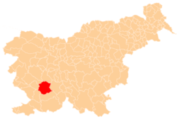
 Mala Brda Location in Slovenia | |
| Coordinates: 45°46′17.66″N 14°5′43.54″E / 45.7715722°N 14.0954278°ECoordinates: 45°46′17.66″N 14°5′43.54″E / 45.7715722°N 14.0954278°E | |
| Country |
|
| Traditional region | Inner Carniola |
| Statistical region | Littoral–Inner Carniola |
| Municipality | Postojna |
| Area | |
| • Total | 1.36 km2 (0.53 sq mi) |
| Elevation | 572.6 m (1,878.6 ft) |
| Population (2002) | |
| • Total | 44 |
| [1] | |
Mala Brda (pronounced [ˈmaːla ˈbəɾda]) is a small settlement west of Postojna, just off the road towards Razdrto, in the Inner Carniola region of Slovenia.[2]
References
External links
| Settlements | Administrative centre: Postojna
|  |
|---|---|---|
| Landmarks |
| |
| Notable people |
| |
This article is issued from Wikipedia - version of the 3/22/2015. The text is available under the Creative Commons Attribution/Share Alike but additional terms may apply for the media files.