M-239 (Michigan highway)
| ||||
|---|---|---|---|---|
 | ||||
| Route information | ||||
| Maintained by MDOT | ||||
| Length: | 1.136 mi[1] (1.828 km) | |||
| Existed: | 1963[2][3] – present | |||
| Major junctions | ||||
| South end: |
| |||
| North end: |
| |||
| Location | ||||
| Counties: | Berrien | |||
| Highway system | ||||
| ||||

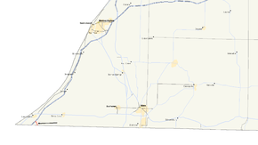
M-239 is a north–south state trunkline highway in Berrien County in the extreme southwestern corner of the US state of Michigan connecting State Road 39 (SR 39) in Indiana to Interstate 94 (I-94). The highway was designated in 1963, and it provided the only connection from the southern end of I-94 into Indiana until 1972.
Route description
As SR 39 crosses into Michigan it becomes M-239. As soon as it crosses the border, the road curves around to the northwest where it continues through a generally rural area. The trunkline intersects Wilson Road and passes next to a commercial development. After a little over a mile (1.8 km), the road comes to its northern terminus at an interchange with I-94 at exit 1. While M-239 officially ends at the interchange, the roadway, known as Harbor Country Drive, continues on to the northwest where it heads into New Buffalo.[4][5] Like other state highways in Michigan, M-239 is maintained by the Michigan Department of Transportation (MDOT). In 2011, the department's traffic surveys showed that on average, 6,231 vehicles used the highway daily.[6] No section of M-239 is listed on the National Highway System,[7] a network of roads important to the country's economy, defense, and mobility.[8]
History
M-239 always ended at I-94, even though Harbor Country Drive continues into New Buffalo. Before completion of the Indiana portion of I-94, the freeway ended at the present exit 1. A 1.1-mile-long (1.8 km) stretch of LaPorte Road[lower-alpha 1] was designated as M-239 in 1963 to carry traffic to SR 39, which connects to the Indiana Toll Road.[2][3] Until 1972, when Indiana constructed their section of I-94, M-239 and SR 39 were the only connection from the southern end of I-94 in Michigan across the state line.[10][11]
Major intersections
The entire highway is in New Buffalo Township, Berrien County.
| mi[1] | km | Destinations | Notes |
|---|---|---|---|
| 0.000 | 0.000 | Indiana state line | |
| 1.136 | 1.828 | ||
| 1.000 mi = 1.609 km; 1.000 km = 0.621 mi | |||
See also
 Michigan Highways portal
Notes
References
- 1 2 Michigan Department of Transportation & Michigan Center for Shared Solutions and Technology Partnerships (2009). MDOT Physical Reference Finder Application (Map). Michigan Department of Transportation. Retrieved June 30, 2012.
- 1 2 Michigan State Highway Department (1963). Official Highway Map (Map). [c. 1:918,720]. Lansing: Michigan State Highway Department. § N7. OCLC 12701120.
- 1 2 Michigan State Highway Department (1964). Official Highway Map (Map). [c. 1:918,720]. Lansing: Michigan State Highway Department. § N7. OCLC 12701120, 81213707.
- ↑ Michigan Department of Transportation (2012). Pure Michigan: State Transportation Map (Map). c. 1:975,000. Lansing: Michigan Department of Transportation. § N7. OCLC 42778335, 794857350.
- ↑ Google (July 2, 2012). "Overview Map of M-239" (Map). Google Maps. Google. Retrieved July 2, 2012.
- ↑ Bureau of Transportation Planning (2008). "Traffic Monitoring Information System". Michigan Department of Transportation. Retrieved June 30, 2012.
- ↑ Michigan Department of Transportation (April 23, 2006). National Highway System, Michigan (PDF) (Map). Scale not given. Lansing: Michigan Department of Transportation. Retrieved October 7, 2008.
- ↑ Natzke, Stefan; Neathery, Mike & Adderly, Kevin (June 20, 2012). "What is the National Highway System?". National Highway System. Federal Highway Administration. Retrieved July 1, 2012.
- ↑ Gudas, Ray (January 31, 2009). "'Gateway' to Area Laporte Road Renamed to Promote Idea of Harbor Country Region". The Herald-Palladium. St. Joseph, MI. Archived from the original on January 9, 2015. Retrieved January 9, 2015.
- ↑ Michigan Department of State Highways (1972). Michigan, Great Lake State: Official Highway Map (Map). c. 1:918,720. Lansing: Michigan Department of State Highways. § N7. OCLC 12701120.
- ↑ Michigan Department of State Highways (1973). Michigan, Great Lake State: Official Highway Map (Map). c. 1:918,720. Lansing: Michigan Department of State Highways. § N7. OCLC 12701120, 81679137.