Lwandle
| Lwandle | |
|---|---|
 Lwandle 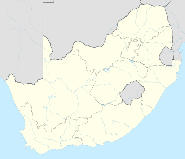 Lwandle  Lwandle
| |
|
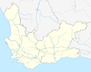
Location within Cape Town 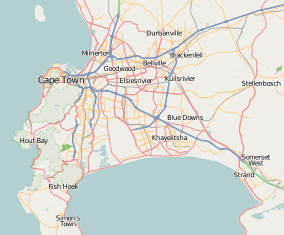 Lwandle | |
| Coordinates: 34°07′16″S 18°51′55″E / 34.1211°S 18.8654°ECoordinates: 34°07′16″S 18°51′55″E / 34.1211°S 18.8654°E | |
| Country | South Africa |
| Province | Western Cape |
| Municipality | City of Cape Town |
| Established | 1958 |
| Area[1] | |
| • Total | 1.21 km2 (0.47 sq mi) |
| Population (2011)[1] | |
| • Total | 19,818 |
| • Density | 16,000/km2 (42,000/sq mi) |
| Racial makeup (2011)[1] | |
| • Black African | 96.1% |
| • Coloured | 3.1% |
| • Indian/Asian | 0.1% |
| • White | 0.1% |
| • Other | 0.5% |
| First languages (2011)[1] | |
| • Xhosa | 82.7% |
| • Afrikaans | 4.4% |
| • Sotho | 3.4% |
| • English | 2.5% |
| • Other | 7.0% |
| Postal code (street) | 7140 |
| PO box | 7143 |
Lwandle is a township in Somerset West, a town in the eastern part of the Cape Town Metro in the Western Cape province of South Africa. Under Apartheid it was a group area for black people and is still predominantly populated by this community.
References
- 1 2 3 4 "Sub Place Lwandle". Census 2011.
See also
.svg.png)
This article is issued from Wikipedia - version of the 10/2/2016. The text is available under the Creative Commons Attribution/Share Alike but additional terms may apply for the media files.