Lalganj (community development block)
| Lalganj लालगंज | |
|---|---|
| Community Development Block | |
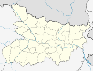 Lalganj Location in bihar , India | |
| Coordinates: 25°52′26″N 85°10′47″E / 25.873818°N 85.179735°ECoordinates: 25°52′26″N 85°10′47″E / 25.873818°N 85.179735°E | |
| Country |
|
| State | Bihar |
| District | vaishali |
| District Sub-division | Hajipur[1] |
| Anchal | Lalganj[1] |
| Vidhan Sabha constituency | Lalganj[2] |
| Government | |
| • Type | Community development block |
| Population (2001) | |
| • Total | 203,729[1] |
| Languages | |
| • Official | Hindi |
| Time zone | IST (UTC+5:30) |
Lalganj ( in Hindi : लालगंज ) is a block in vaishali district,[3] bihar state,.[1] It is also the birthplace of veteran IPS and former Governor of Kerala and Nagaland Shri Nikhil Kumar Singh.According to census website all blocks in bihar state Nomenclature as C.D.Block ( community development blocks [4]
major roads
SH-74[5]
villages
- Number of Panchayat : 21
- Number of Villages : 92[1]
panchayat
Villages
- Main article: List of villages in Lalganj block
Population and communities
- Male Population : 105532 (2009 ist.)
- female Population : 98197
- Total Population : 203729
- SC Total Population : 44009
- ST Total Population : 495
- Minority Total Population : 15252
- Population Density : 1345
- Sex Ratio : 930
public distribution system
- Nos of HHs : 31082
- BPL Card Holders : 32880
- Antodaya Card Holders : 6937
- Annapurna Card Holders : 238
- APL : 17289
- Nos of Fair Price Shops: 104[1]
Education
- literacy rate : 51% (2001 ist.)
- male literacy rate : 63%
- Female literacy rate : 38%
School
- Primary School : 101 (2009 ist.)
- Upper Primary School : 83
Banking
- number of bank : 6
References
- 1 2 3 4 5 6 7 8 9 10 "Vaishali at a Glance" (PDF). vaishali.bih.nic.in. Retrieved 24 November 2014.
- ↑ Lalganj Assembly constituency -- chief Electoral Officer official website
- ↑ BLOCK DEVELOPMENT OFFICER -- vaishali district official website
- ↑ Statement showing the Nomenclature and Number of sub district in states/UTs s.n. 10 bihar state]]
- ↑ "Vaishali District map - official government website". vaishali.bih.nic.in.file type: image/jpg, file size: 13.9MB
- ↑ Lalganj panchayat directory
This article is issued from Wikipedia - version of the 10/17/2016. The text is available under the Creative Commons Attribution/Share Alike but additional terms may apply for the media files.