Lac-Marguerite, Quebec
| Lac-Marguerite | |
|---|---|
| Unorganized territory | |
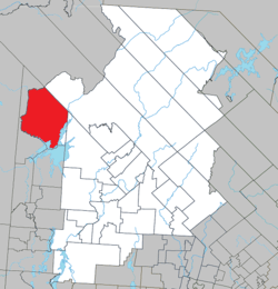 Location within Antoine-Labelle RCM. | |
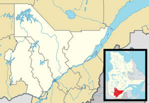 Lac-Marguerite Location in central Quebec. | |
| Coordinates: 47°02′N 75°48′W / 47.033°N 75.800°WCoordinates: 47°02′N 75°48′W / 47.033°N 75.800°W[1] | |
| Country |
|
| Province |
|
| Region | Laurentides |
| RCM | Antoine-Labelle |
| Constituted | January 1, 1986 |
| Government[2] | |
| • Federal riding | Laurentides—Labelle |
| • Prov. riding | Labelle |
| Area[2][3] | |
| • Total | 923.00 km2 (356.37 sq mi) |
| • Land | 818.74 km2 (316.12 sq mi) |
| Population (2011)[3] | |
| • Total | 0 |
| • Density | 0.0/km2 (0/sq mi) |
| • Pop 2006-2011 |
|
| • Dwellings | 0 |
| Time zone | EST (UTC−5) |
| • Summer (DST) | EDT (UTC−4) |
| Highways | No major routes |
Lac-Marguerite is an unorganized territory in Antoine-Labelle Regional County Municipality in the Laurentides region of Quebec, Canada.
Demographics
Population trend:[4]
- Population in 2011: 0
- Population in 2006: 0
- Population in 2001: 0
- Population in 1996: 0
- Population in 1991: 0
See also
References
- ↑ Reference number 149852 of the Commission de toponymie du Québec (French)
- 1 2 Geographic code 79926 in the official Répertoire des municipalités (French)
- 1 2 Statistics Canada 2011 Census - Lac-Marguerite profile
- ↑ Statistics Canada: 1996, 2001, 2006, 2011 census
 |
Lac-Lenôtre | Lac-Douaire | | |
| Cascades-Malignes | |
Ferme-Neuve | ||
| ||||
| | ||||
| Grand-Remous |
| Cities/towns | |
|---|---|
| Municipalities | |
| Villages | |
| Unorganized territories | |
| |
This article is issued from Wikipedia - version of the 3/8/2014. The text is available under the Creative Commons Attribution/Share Alike but additional terms may apply for the media files.