Koti-Se-Phola
| Koti-Se-Phola | |
|---|---|
| Community Council | |
|
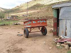
The headman's trailer in Ha 'Ngoae | |
 Koti-Se-Phola Geographic Center of Community | |
| Coordinates: 29°57′24″S 27°25′25″E / 29.95667°S 27.42361°E | |
| Country |
|
| District | Mafeteng District |
| Elevation[1] | 5,761 ft (1,756 m) |
| Population (2006) | |
| • Total | 12,391 |
| Time zone | CAT (UTC+2) |
| Coordinates computed from Lesotho Villages file.[2] | |
Koti-Se-Phola is a community council located in the Mafeteng District of Lesotho. Its population in 2006 was 12,391.[3]
Villages
The community of Koti-Se-Phola includes the villages of[4]
|
Foreisetata |
Ha Lekoatsa |
Ha Sechaba |
Makoabating |
References
- ↑ GTOPO30 via GeoNames. Retrieved 2010-12-23.
- ↑ Google Earth Download Site Retrieved 2010-07-21.
- ↑ Statoids.com
- ↑ Lesotho Bureau of Statistics, Village List 2006.
External links
This article is issued from Wikipedia - version of the 11/9/2016. The text is available under the Creative Commons Attribution/Share Alike but additional terms may apply for the media files.