Kollipara
| Kollipara కొల్లిపర | |
|---|---|
| Village | |
|
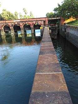
Kollipara lock | |
 Kollipara  Kollipara Location in Andhra Pradesh, India | |
| Coordinates: 16°17′16″N 80°45′07″E / 16.287735°N 80.751927°ECoordinates: 16°17′16″N 80°45′07″E / 16.287735°N 80.751927°E | |
| Country | India |
| State | Andhra Pradesh |
| District | Guntur |
| Mandal | Kollipara |
| Area[1] | |
| • Total | 17.43 km2 (6.73 sq mi) |
| Population (2011)[2] | |
| • Total | 12,982 |
| • Density | 740/km2 (1,900/sq mi) |
| Languages | |
| • Official | Telugu |
| Time zone | IST (UTC+5:30) |
| PIN | 522304 |
| Vehicle registration | AP |
Kollipara is a village in Guntur district of the Indian state of Andhra Pradesh. It is located in Kollipara mandal of Tenali revenue division.[1] The major occupation of the village is agriculture, which includes cultivation of paddy.[3]
See also
References
- 1 2 "District Census Handbook – Guntur" (PDF). Census of India. The Registrar General & Census Commissioner. pp. 14,402. Retrieved 23 June 2016.
- ↑ "Census 2011". The Registrar General & Census Commissioner, India. Retrieved 12 August 2014.
- ↑ "Helen causes extensive damage to crops". The New Indian Express. Vijayawada. 25 November 2013. Retrieved 26 February 2016.
This article is issued from Wikipedia - version of the 9/16/2016. The text is available under the Creative Commons Attribution/Share Alike but additional terms may apply for the media files.