Kluang Inner Ring Road
| |
|---|---|
| Kluang Inner Ring Road | |
| Route information | |
| Length: | 2.6 km (1.6 mi) |
| Major junctions | |
| Southwest end: |
|
|
J25 J191 | |
| Southeast end: | Bulatan Jalan Sekolah |
| Location | |
| Primary destinations: |
Hospital Kluang Kampung Melayu Niyor |
| Highway system | |
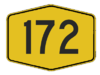
Kluang Inner Ring Road comprising Jalan Hospital, Jalan Rambutan and Jalan Mohd Salim, Federal Route 172 (formerly Johor State Route J191), is a federal road in Kluang town, Johor, Malaysia.[1]
Features
At most sections, the Federal Route 172 was built under the JKR R5 road standard, allowing maximum speed limit of up to 90 km/h.
List of junctions
| Km | Exit | Junctions | To | Remarks |
|---|---|---|---|---|
| Jalan Batu Pahat-Jalan Mersing | West Kuala Lumpur Johor Bahru East J16 South J25 Mengkibol Renggam Simpang Renggam Layang-Layang | Junctions | ||
| Sekolah Agama Bandar Kluang | ||||
| Kluang Railway Station | ||||
| Hospital Kluang | Hospital Kluang | |||
| Railway crossing bridge | ||||
| Jalan Haji Manan | Jalan Haji Manan North Taman Suria Taman Lian Seng South Town Centre | T-junctions | ||
| Jalan Haji Ithnin Maarof | North J191 Kampung Melayu Niyor | T-junctions | ||
| Sungai Mengkibol bridge | ||||
| Jalan Penghulu Kassim | West Jalan Penghulu Kassim Town Centre | T-junctions | ||
| Bulatan Jalan Sekolah | West Kuala Lumpur Johor Bahru East J16 South Jalan Sekolah Taman Kurnia | Roundabout |
References
- ↑ Statistik Jalan (Edisi 2013). Kuala Lumpur: Malaysian Public Works Department. 2013. p. 16-64. ISSN 1985-9619.

This article is issued from Wikipedia - version of the 6/11/2016. The text is available under the Creative Commons Attribution/Share Alike but additional terms may apply for the media files.