Heers
- For the hamlet with the same name in the Netherlands, see: Heers, Netherlands.
| Heers | |||
|---|---|---|---|
| Municipality | |||
|
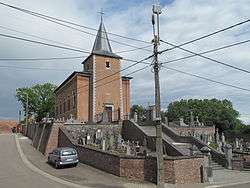
Vechmaal: Sint Martinus church | |||
| |||
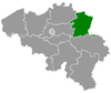
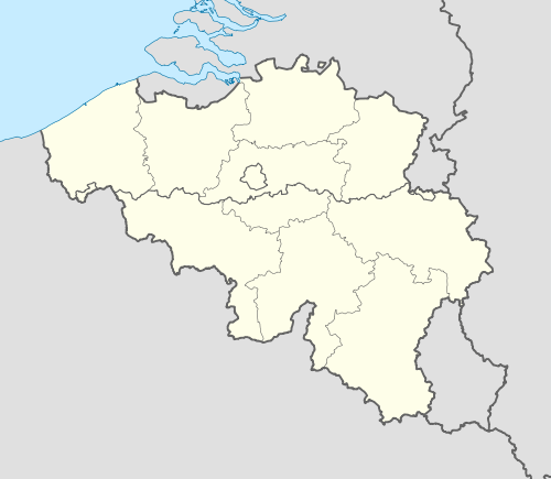 Heers Location in Belgium | |||
|
Location of Heers in Limburg 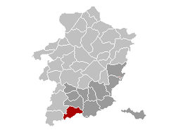 | |||
| Coordinates: 50°45′N 05°17′E / 50.750°N 5.283°ECoordinates: 50°45′N 05°17′E / 50.750°N 5.283°E | |||
| Country | Belgium | ||
| Community | Flemish Community | ||
| Region | Flemish Region | ||
| Province | Limburg | ||
| Arrondissement | Tongeren | ||
| Government | |||
| • Mayor | Gerald Kindermans (CD&V) | ||
| • Governing party/ies | CD&V, VLD | ||
| Area | |||
| • Total | 53.07 km2 (20.49 sq mi) | ||
| Population (1 January 2016)[1] | |||
| • Total | 7,205 | ||
| • Density | 140/km2 (350/sq mi) | ||
| Postal codes | 3870 | ||
| Area codes | 011 | ||
| Website | www.heers.be | ||


Heers (Limburgish: Hiër) is a municipality located in the Belgian province of Limburg. Since 1971 it comprises the parishes Batsheers, Opheers, Veulen, Gutschoven and Mettekoven, and since 1977 also Mechelen-Bovelingen, Rukkelingen-Loon (which in 1971 had formed Bovelingen), Heks, Horpmaal, Vechmaal (which in 1971 had formed Heks), and Klein-Gelmen (which between 1971 and 1977 had been part of Gelmen, during those years a separate municipality of which the other parishes now belong to the municipality of Sint-Truiden).
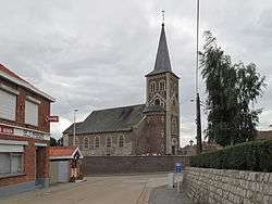
Horpmaal, church: de Sint Lambertuskerk
References
- ↑ Population per municipality as of 1 January 2016 (XLS; 397 KB)
External links
-
 Media related to Heers at Wikimedia Commons
 - Site (personal) on Heers – Description of and historical information about each of the parishes of Heers (Dutch)
 |
Sint-Truiden | Borgloon | | |
| Gingelom | |
Tongeren | ||
| ||||
| | ||||
| Waremme (WLG), Oreye (WLG) |
This article is issued from Wikipedia - version of the 12/1/2016. The text is available under the Creative Commons Attribution/Share Alike but additional terms may apply for the media files.