Khashtarak
Coordinates: 40°56′19″N 45°10′47″E / 40.93861°N 45.17972°E
| Khashtarak Խաշթառակ | |
|---|---|
 | |
 Khashtarak Խաշթառակ | |
| Coordinates: 40°56′19″N 45°10′47″E / 40.93861°N 45.17972°E | |
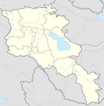
| Country | Armenia |
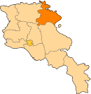
| Marz (Province) | Tavush |
| Population (2011) | |
| • Total | 1,771 |
| Time zone | (UTC+4) |
| • Summer (DST) | (UTC+5) |
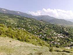
Khashtarak (Armenian: Խաշթառակ, also Romanized as Khasht’arrak and Khashtarrak) is a village in the Tavush Province of Armenia. Within the village is a recently built church, and nearby west and southeast are abandoned medieval settlements with khachkars.
Recently, Khashtarak has witnessed many charitable activities applied by the All-Armenia Fund. The medical centre of the village, the kindergarten and the public-education school were all renovated by the efforts of Diasporan Armenians.
Gallery
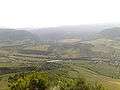 Khashtarak nature
.jpg) One of the three cross-symbols of Khashtarak
One of the three cross-symbols of Khashtarak
References
- Khashtarak at GEOnet Names Server
- World Gazeteer: Armenia – World-Gazetteer.com
- Report of the results of the 2001 Armenian Census, National Statistical Service of the Republic of Armenia
This article is issued from Wikipedia - version of the 10/23/2015. The text is available under the Creative Commons Attribution/Share Alike but additional terms may apply for the media files.