Kalikot District
| Kālikot Jillā कालीकोट जिल्ला | |
|---|---|
| District | |
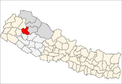 Location of Kalikot | |
| Country | Nepal |
| Region | Mid-Western (grey) |
| Zone | Karnali (darker grey) |
| Headquarters | Manma |
| Area | |
| • Total | 1,741 km2 (672 sq mi) |
| Population (2011) | |
| • Total | 136,948 |
| • Density | 79/km2 (200/sq mi) |
| Time zone | NPT (UTC+5:45) |
Kalikot District(Nepali: कालीकोट जिल्ला![]() Listen , a part of Province No. 6, is one of the seventy-five districts of Nepal. The district, with Manma as its district headquarters, covers an area of 1,741 km², had a population of 105,580 in 2001 and 136,948 in 2011. In September 2005, in a bid to encourage a change in social attitudes, the government announced that it would provide rice to any family that had recently had a girl born.[1]
Listen , a part of Province No. 6, is one of the seventy-five districts of Nepal. The district, with Manma as its district headquarters, covers an area of 1,741 km², had a population of 105,580 in 2001 and 136,948 in 2011. In September 2005, in a bid to encourage a change in social attitudes, the government announced that it would provide rice to any family that had recently had a girl born.[1]
Geography and Climate
| Climate Zone[2] | Elevation Range | % of Area |
|---|---|---|
| Upper Tropical | 300 to 1,000 meters 1,000 to 3,300 ft. |
1.8% |
| Subtropical | 1,000 to 2,000 meters 3,300 to 6,600 ft. |
20.6% |
| Temperate | 2,000 to 3,000 meters 6,400 to 9,800 ft. |
39.4% |
| Subalpine | 3,000 to 4,000 meters 9,800 to 13,100 ft. |
37.3% |
| Alpine | 4,000 to 5,000 meters 13,100 to 16,400 ft. |
0.8% |
Village Development Committees (VDCs)
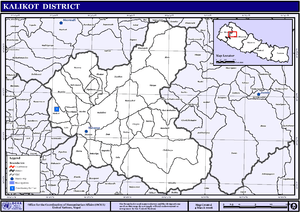
Map of the VDCs in Kalikot District
- Badalkot
- Bharta
- Chhapre
- Chilkhaya
- Daha
- Dholagohe
- Gela
- Jubitha
- Khin
- Kotbada
- Kumalgaun
- Lalu
- Malkot
- Manma
- Mehalmudi
- Mugraha
- Mumra
- Nanikot
- Odanaku
- Pakha
- Phoi Mahadev
- Phukot
- Ranku
- Ramnakot
- Ranchuli
- Rupsa
- Sipkhana
- Sukitaya
- Syuna
- Thirpu
See also
References
- ↑ Country Reports on Human Rights Practices - 2005 - US Department of State
- ↑ The Map of Potential Vegetation of Nepal - a forestry/agroecological/biodiversity classification system (PDF), . Forest & Landscape Development and Environment Series 2-2005 and CFC-TIS Document Series No.110., 2005, ISBN 87-7903-210-9, retrieved Nov 22, 2013 horizontal tab character in
|series=at position 91 (help)
External links

Coordinates: 29°9′0″N 81°37′0″E / 29.15000°N 81.61667°E
| Wikimedia Commons has media related to Kalikot District. |
This article is issued from Wikipedia - version of the 3/25/2016. The text is available under the Creative Commons Attribution/Share Alike but additional terms may apply for the media files.