Jalan M.H. Thamrin
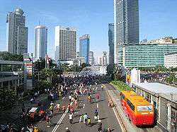
Jalan MH Thamrin during a Car Free Day
Jalan MH Thamrin is a major road in Jakarta – named in honor of the national hero Mohammad Husni Thamrin – which runs through the Central Business District.
Jalan MH Thamrin is part of Jakarta Car Free Days, which means it is closed from 6:00 until 11:00 to traffic every Sunday.
Major buildings along Jalan MH Thamrin
| West | East |
|---|---|
| Bank Indonesia | Sekretariat ESDM |
| Department of Religion Republik Indonesia | Bank Rama |
| Badan Perencanaan dan Penerapan Teknologi (BPPT) | Bank Bangkok |
| Menara Thamrin | Bank Mandiri Syariah |
| Gedung Jaya | Hotel Sari Pan Pacific |
| Badan Pengawas Pemilihan Umum (Bawaslu) | Menara Cakrawala |
| Menara Eksekutif | Sarinah |
| Thamrin Office Park | Kedutaan besar Perancis |
| EX Plaza | Plaza BII |
| Kedutaan besar Jepang | Wisma Kosgoro |
| The Kraton Tower | Oil Center Jakarta |
| The Plaza Tower | Plaza Permata |
| Plaza Indonesia and Grand Hyatt Jakarta | Hotel Nikko |
| Hotel Indonesia, Grand Indonesia Shopping Town and Kempinski Residence | Wisma Nusantara |
| Menara BCA | Kedutaan besar Inggris |
| OUB Plaza | Deutsche Bank |
| The Thamrin Nine | Hotel Mandarin Oriental |
| Kedutaan besar Jerman | |
| The City Tower |
Busway stops
Bus stop TransJakarta Bunderan HI
There are numerous stops of the TransJakarta bus systems along Jalan MH Thamrin for the route Blok M - Kota Tua Jakarta. Stops along the way include.
- Tosari, close to Grand Indonesia Shopping Town, in front of OUB Plaza and The City Tower
- Bunderan HI, close to Bunderan HI, in front of Plaza Indonesia and Hotel Nikko
- Sarinah, in front of Sarinah, Gedung Badan Pengawas Pemilihan Umum and Menara Eksekutif
- Bank Indonesia, in front of Bank Indonesia and Indosurya Center
Intersections
This road has four intersections:
- Bunderan Air Mancur Bank Indonesia (towards Tanah Abang, Jalan Merdeka Barat and Jalan Merdeka Selatan)
- Intersection Bank Mandiri Syariah (towards Tanah Abang and Kebon Sirih area)
- Intersection Sarinah (towards Tanah Abang and Kebon Sirih area)
- Bunderan HI (towards Jalan Sudirman, Kebon Kacang, Menteng, and Suropati)
Coordinates: 6°11′26″S 106°49′23″E / 6.190498°S 106.822924°E
This article is issued from Wikipedia - version of the 6/16/2016. The text is available under the Creative Commons Attribution/Share Alike but additional terms may apply for the media files.