Hitiaa O Te Ra
| Hitiaa O Te Ra | |
|---|---|
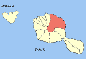 Location of the commune (in red) within the Windward Islands | |
| Coordinates: 17°37′S 149°19′W / 17.61°S 149.31°WCoordinates: 17°37′S 149°19′W / 17.61°S 149.31°W | |
| Country | France |
| Overseas collectivity | French Polynesia |
| Government | |
| • Mayor | Domingo Dauphin |
| Area | 218.2 km2 (84.2 sq mi) |
| Population (August 2007 census)1 | 8,683 |
| • Density | 40/km2 (100/sq mi) |
| INSEE/Postal code | 98722 / 98705 |
| Elevation | 0–2,241 m (0–7,352 ft) |
| 1 Population without double counting: residents of multiple communes (e.g., students and military personnel) only counted once. | |
Hitiaa O Te Ra is a commune of French Polynesia, an overseas territory of France in the Pacific Ocean. The commune of Hitiaa O Te Ra is located on the island of Tahiti, in the administrative subdivision of the Windward Islands, themselves part of the Society Islands.
Hitiaa O Te Ra consists of the following associated communes:
- Hitiaa
- Mahaena
- Papenoo
- Tiarei
The administrative centre of the commune is the settlement of Hitiaa.
| Wikimedia Commons has media related to Hitia’a O Te R. |
This article is issued from Wikipedia - version of the 5/25/2015. The text is available under the Creative Commons Attribution/Share Alike but additional terms may apply for the media files.