Helme Parish
| Helme Parish Helme vald | |||
|---|---|---|---|
| Municipality of Estonia | |||
|
| |||
| |||
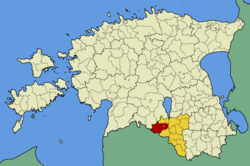 Helme Parish within Valga County. | |||
| Country |
| ||
| County |
| ||
| Administrative centre | Tõrva | ||
| Government | |||
| • vallavanem | Tarmo Tamm (Sotsiaaldemokraatlik Erakond) | ||
| Area | |||
| • Total | 312.73 km2 (120.75 sq mi) | ||
| Population (01.01.2009) | |||
| • Total | 2,525 | ||
| • Density | 8.1/km2 (21/sq mi) | ||
| Website | www.helme.ee | ||
.jpg)


Helme Parish (Estonian: Helme vald) is a rural municipality of Estonia, in Valga County. It has a population of 2,525 (as of 1 January 2009) and an area of 312.73 km².[1]
Geography
Populated places
There is one small borough (Estonian: alevik) Helme and 14 villages (Estonian: küla) in Helme Parish. The villages are: Ala, Holdre, Jõgeveste, Kähu, Kalme, Karjatnurme, Kirikuküla, Koorküla, Linna, Möldre, Patküla, Pilpa, Roobe and Taagepera.
Gallery
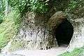 Helme caves
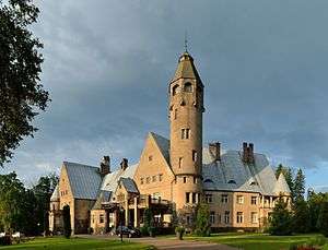
 Holdre manor
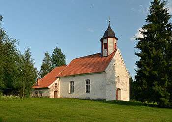
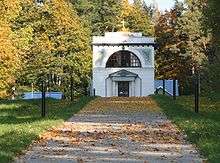 Barclay de Tolly mausoleum in Jõgeveste
References
- ↑ "Population figure and composition". Statistics Estonia. Retrieved 1 February 2010. External link in
|publisher=(help)
External links
- Official website (Estonian)
Coordinates: 58°0′10″N 25°55′25″E / 58.00278°N 25.92361°E
| Urban municipalities | ||
|---|---|---|
| Rural municipalities | ||
This article is issued from Wikipedia - version of the 5/24/2016. The text is available under the Creative Commons Attribution/Share Alike but additional terms may apply for the media files.