Gōnokawa River
| Gōnokawa River | |
|---|---|
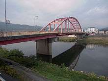 The Tomoe Bridge over the Basen River in Miyoshi | |
| Native name | 江の川 / ごうのかわ |
| Country | Japan |
| Basin | |
| Main source |
Mount Asa 1,218 m (3,996 ft) |
| River mouth | Gōtsu |
| Basin size | 3,870 km2 (1,490 sq mi) |
| Physical characteristics | |
| Length | 194 km (121 mi) |
| Discharge |
|
The Gōnokawa River (江の川 ごうのかわ, Gōnokawa) is a river that runs through Hiroshima and Shimane prefectures in Japan. It is the largest river in the Chūgoku region. It is also called the Gōgawa River (江川|ごうかわ) and, in Hiroshima, the Enokawa River (可愛川).[1]
River communities
The river passes through or borders the following communities:
- Hiroshima Prefecture
- Kitahiroshima, Akitakata, Miyoshi
- Shimane Prefecture
- Ōnan, Misato, Kawamoto, Gōtsu
References
- ↑ "江の川" [Gōnokawa River]. Nihon Rekishi Chimei Taikei (in Japanese). Tokyo: Shogakukan. 2012. OCLC 173191044. dlc 2009238904. Retrieved 2012-09-11.
Coordinates: 35°01′32″N 132°13′37″E / 35.02556°N 132.22694°E
This article is issued from Wikipedia - version of the 8/12/2016. The text is available under the Creative Commons Attribution/Share Alike but additional terms may apply for the media files.