Edward Island
| Edvard Ø | |
|---|---|
 Edward Island Edward Island (Greenland) | |
| Geography | |
| Location | Greenland Sea |
| Coordinates | 76°37′N 21°20′W / 76.617°N 21.333°WCoordinates: 76°37′N 21°20′W / 76.617°N 21.333°W |
| Area | 115.8 km2 (44.7 sq mi) |
| Length | 14.4 km (8.95 mi) |
| Width | 8.6 km (5.34 mi) |
| Coastline | 53.5 km (33.24 mi) |
| Highest elevation | 231 m (758 ft) |
| Administration | |
| Zone | Northeast Greenland National Park |
| Demographics | |
| Population | 0 |
Edward Island (Danish: Edvard Ø)[1] is an uninhabited island of the Greenland Sea, Greenland. The island is unglaciated.
Geography
Edward Island is a coastal island located east of Queen Louise Land, off Cape Stop, east of Borge Fjord and north of Godfred Hansen Island in the Dove Bay, northeastern Greenland.[2] The island has an area of 115.8 km2 (44.7 sq mi) and a shoreline of 53.5 km (33.2 mi).[3]
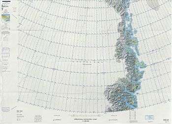
Map of Northeastern Greenland
See also
References
- ↑ "Edvard Ø". Mapcarta. Retrieved 10 April 2016.
- ↑ Prostar Sailing Directions 2005 Greenland and Iceland Enroute, p. 126
- ↑ UNEP
This article is issued from Wikipedia - version of the 11/24/2016. The text is available under the Creative Commons Attribution/Share Alike but additional terms may apply for the media files.