Doldersum
Coordinates: 52°53′N 6°15′E / 52.883°N 6.250°E
| Doldersum | |
|---|---|
 | |
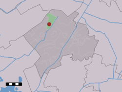 The village (dark red) and the statistical district (light green) of Doldersum in the municipality of Westerveld. | |
| Country | Netherlands |
| Province | Drenthe |
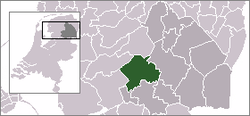
| Municipality | Westerveld |
| Population | ca. 70 |
Doldersum is a hamlet in the Dutch province of Drenthe. It is a part of the municipality of Westerveld, and lies about 24 km northwest of Hoogeveen.
The statistical area "Doldersum", which can also include the surrounding countryside, has a population of around 120.[1]
References
- ↑ Statistics Netherlands (CBS), Statline: Kerncijfers wijken en buurten 2003-2005. As of 1 January 2005.
This article is issued from Wikipedia - version of the 2/20/2015. The text is available under the Creative Commons Attribution/Share Alike but additional terms may apply for the media files.