Culaba, Biliran
| Culaba | |
|---|---|
| Municipality | |
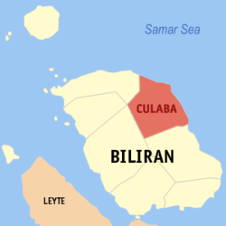 Map of Biliran with Culaba highlighted | |
.svg.png) Culaba Location within the Philippines | |
| Coordinates: 11°39′N 124°33′E / 11.65°N 124.55°ECoordinates: 11°39′N 124°33′E / 11.65°N 124.55°E | |
| Country | Philippines |
| Region | Eastern Visayas (Region VIII) |
| Province | Biliran |
| District | Lone district |
| Founded | October 14, 1953 |
| Municipality | January 16, 1954 |
| Barangays | 17 |
| Government[1] | |
| • Type | Municipality |
| • Mayor | Lorenzo Reveldez ,Jr. (UNA) |
| • Vice-Mayor | Leslie Ann U. Jayme (LP) |
| Area[2] | |
| • Total | 73.42 km2 (28.35 sq mi) |
| Population (2015 census)[3] | |
| • Total | 12,325 |
| • Density | 170/km2 (430/sq mi) |
| Time zone | PST (UTC+8) |
| ZIP code | 6547 |
| IDD : area code | +63 (0)53 |
| Website |
www |
Culaba is a fifth class municipality in the province of Biliran, Philippines. According to the 2015 census, it has a population of 12,325 people.[3]
Barangays
Culaba is politically subdivided into 17 barangays.[2]
- Acaban
- Bacolod
- Binongtoan
- Bool Central
- Bool East
- Bool West
- Calipayan
- Guindapunan
- Habuhab
- Looc
- Marvel
- Patag
- Pinamihagan
- Poblacion (Culaba Central)
- Salvacion
- San Roque
- Virginia
Demographics
| Population census of Culaba | ||
|---|---|---|
| Year | Pop. | ±% p.a. |
| 1990 | 9,822 | — |
| 1995 | 12,703 | +4.94% |
| 2000 | 11,506 | −2.10% |
| 2007 | 10,962 | −0.67% |
| 2010 | 12,252 | +4.13% |
| 2015 | 12,325 | +0.11% |
| Source: Philippine Statistics Authority[3][4][5] | ||
In the 2015 census, the population of Culaba was 12,325 people,[3] with a density of 170 inhabitants per square kilometre or 440 inhabitants per square mile.
Education
Secondary schools:
- Culaba National Vocational School
- Bool National High School
Elementary schools:
- Acaban Elementary School
- Bacolod Elementary School
- Binongtoan Elementary School
- Bool Elementary School
- Culaba Central School
- Calipayan Elementary School
- Habuhab Elementary School
- Looc Elementary School
- Patag Elementary School
- Pinamihagan Elementary School
- Salvation Elementary School
- San Roque Elementary School
Hospital and Health Centers
- Culaba Community Hospital
- Bool Health Center
- Bacolod Health Center
- Pinamihagan Health Center
References
- ↑ "Municipalities". Quezon City, Philippines: Department of the Interior and Local Government. Archived from the original on 25 January 2013. Retrieved 29 January 2013.
- 1 2 "Province: Biliran". PSGC Interactive. Makati City, Philippines: National Statistical Coordination Board. Archived from the original on 14 November 2012. Retrieved 29 January 2013.
- 1 2 3 4 "Region VIII (EASTERN VISAYAS)". Census of Population (2015): Total Population by Province, City, Municipality and Barangay (Report). PSA. Retrieved 20 June 2016.
- ↑ "Region VIII (EASTERN VISAYAS)". Census of Population and Housing (2010): Total Population by Province, City, Municipality and Barangay (Report). NSO. Retrieved 29 June 2016.
- ↑ "Province of Leyte". Municipality Population Data. LWUA Research Division. Retrieved 26 August 2013.
External links
 |
Kawayan | Samar Sea | | |
| Almeria | |
Samar Sea / Daram, Samar | ||
| ||||
| | ||||
| Naval | Caibiran |
This article is issued from Wikipedia - version of the 12/3/2016. The text is available under the Creative Commons Attribution/Share Alike but additional terms may apply for the media files.