Cowers Lane
| Cowers Lane | |
 Cowers Lane |
|
| OS grid reference | SK306469 |
|---|---|
| District | Amber Valley |
| Shire county | Derbyshire |
| Region | East Midlands |
| Country | England |
| Sovereign state | United Kingdom |
| Post town | BELPER |
| Postcode district | DE56 |
| Dialling code | 01773 55 |
| Police | Derbyshire |
| Fire | Derbyshire |
| Ambulance | East Midlands |
| EU Parliament | East Midlands |
|
|
Coordinates: 53°01′08″N 1°32′42″W / 53.019°N 1.545°W
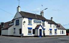
The Railway Inn, Cowers Lane
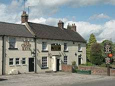
The Cross Keys pub is just South West of Cowers Lane
Cowers Lane is a settlement in Derbyshire bordering Shottle near Belper, Derbyshire England along the A517 road. In Norman times, Shottle Park was one of the seven parks within Duffield Frith. [1]
It was the site of a large shelter for cattle belonging to the Duchy of Lancaster who owned the Frith. It is generally believed that the name is the local dialect equivalent of "Cow House Lane".[2]
References
- ↑ Turbutt, G., (1999) A History of Derbyshire. Volume 2: Medieval Derbyshire, Cardiff: Merton Priory Press
- ↑ Bland, J., (1922) Duffield: Village, Church and Castle, Derby: Harpur and Son
"Cowhouse Lane has a post-office, and the official Post-Office Guide prints the name "Cowers Lane." My father, who deplored the loss of old associations. once asked the then post-master there how this came about. His answer was to this effect: "One day a letter came from the head office, asking me which was the correct name, 'Cowhouse,' or 'Cowers,' so I counted the letters which had come that morning, and as there were more addressed ' Cowers' than 'Cowhouse,' I replied that Cowers was correct." It therefore became and remains, officially, Cowers Lane; so carelessly are place-names distorted and historical connections lost."
This article is issued from Wikipedia - version of the 9/29/2016. The text is available under the Creative Commons Attribution/Share Alike but additional terms may apply for the media files.