Colquechaca Municipality
| Colquechaca Qullqichaka | |
|---|---|
| Municipality | |
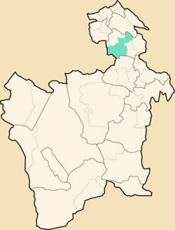 Location within Potosí Department | |
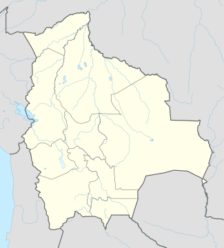 Colquechaca Location within Bolivia | |
| Coordinates: 18°53′S 66°5′W / 18.883°S 66.083°WCoordinates: 18°53′S 66°5′W / 18.883°S 66.083°W | |
| Country |
|
| Department | Potosí Department |
| Province | Chayanta Province |
| Seat | Colquechaca |
| Area | |
| • Total | 713 sq mi (1,846 km2) |
| Elevation | 13,000 ft (4,000 m) |
| Population (2001) | |
| • Total | 31,037 |
| • Ethnicities | Quechua |
| Time zone | -4 (UTC-4) |
Colquechaca (in hispanicized spelling) or Qullqichaka (Quechua qullqi silver, money, chaka bridge,[1] "silver bridge") is the first municipal section of the Chayanta Province in the Potosí Department in Bolivia. Its seat is Colquechaca.
Subdivision
The municipality consists of the following cantons:
- Ayoma
- Colquechaca
- Macha
- Rosario
- Surumi
The people
The people are predominantly indigenous citizens of Quechua descent.[2]
| Ethnic group | % |
|---|---|
| Quechua | 95.3 |
| Aymara | 0.9 |
| Guaraní, Chiquitos, Moxos | 0.0 |
| Not indigenous | 3.8 |
| Other indigenous groups | 0.0 |
References
- ↑ Teofilo Laime Ajacopa, Bolivian Quechua dictionary (Quechua - Spanish, Spanish Quechua)
- ↑ obd.descentralizacion.gov.bo/municipal/fichas/ (inactive)
External links
Capital: Potosí | ||
| Provinces |  | |
| Municipalities (and seats) |
| |
This article is issued from Wikipedia - version of the 8/24/2013. The text is available under the Creative Commons Attribution/Share Alike but additional terms may apply for the media files.