Tour Noir
| Tour Noir | |
|---|---|
|
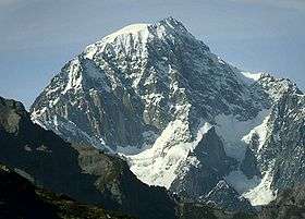
Tour Noir from Val Ferret | |
| Highest point | |
| Elevation | 3,836 m (12,585 ft) |
| Prominence | 302 m (991 ft) [1] |
| Parent peak | Aiguille d'Argentière |
| Coordinates | 45°57′1.1″N 7°2′12.3″E / 45.950306°N 7.036750°ECoordinates: 45°57′1.1″N 7°2′12.3″E / 45.950306°N 7.036750°E |
| Geography | |
 Tour Noir Location in the Alps | |
| Location |
Valais, Switzerland Haute-Savoie, France |
| Parent range | Mont Blanc Massif |
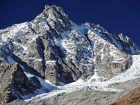
The Tour Noir is a mountain in the Mont Blanc massif on the Swiss-French border. It is located between the Aiguille d'Argentière and Mont Dolent.
See also
References
External links
| Wikimedia Commons has media related to Tour Noir. |
This article is issued from Wikipedia - version of the 1/26/2016. The text is available under the Creative Commons Attribution/Share Alike but additional terms may apply for the media files.