Chapleau 61
| Chapleau 61 | |
|---|---|
| Indian reserve | |
| Chapleau Indian Reserve No. 61 | |
 Chapleau 61 | |
| Coordinates: 47°50′N 83°23′W / 47.833°N 83.383°WCoordinates: 47°50′N 83°23′W / 47.833°N 83.383°W | |
| Country |
|
| Province |
|
| District | Sudbury |
| First Nation | Michipicoten |
| Area[1] | |
| • Land | 0.89 km2 (0.34 sq mi) |
Chapleau 61 is a First Nations reserve[1] close to Chapleau, Ontario. It is one of the reserves of the Michipicoten First Nation.
References
External links
- Canada Lands Survey System (note: listed under Chapleau Ojibway First Nation)
 |
Chapleau 61A | | ||
| Chapleau | |
Unorganized North Sudbury | ||
| ||||
| | ||||
| Chapleau 74 |
| Towns | 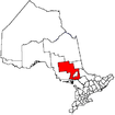 | |
|---|---|---|
| Townships | ||
| First Nations | ||
| Indian reserves | ||
| Unorganized area | ||
| Local services boards | ||
| ||
This article is issued from Wikipedia - version of the 2/19/2016. The text is available under the Creative Commons Attribution/Share Alike but additional terms may apply for the media files.