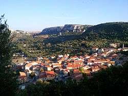
Cargeghe
| Cargeghe Carzèghe | ||
|---|---|---|
| Comune | ||
| Comune di Cargeghe | ||
 | ||
| ||
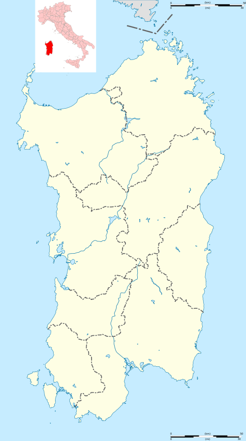 Cargeghe Location of Cargeghe in Sardinia | ||
| Coordinates: 40°40′N 8°37′E / 40.667°N 8.617°E | ||
| Country | Italy | |
| Region | Sardinia | |
| Province / Metropolitan city | Sassari (SS) | |
| Government | ||
| • Mayor | Salvatore Oggiano | |
| Area | ||
| • Total | 12.1 km2 (4.7 sq mi) | |
| Elevation | 333 m (1,093 ft) | |
| Population (30 November 2010[1]) | ||
| • Total | 629 | |
| • Density | 52/km2 (130/sq mi) | |
| Demonym(s) | Cargeghesi | |
| Time zone | CET (UTC+1) | |
| • Summer (DST) | CEST (UTC+2) | |
| Postal code | 07030 | |
| Dialing code | 079 | |
Cargeghe (Sardinian: Carzèghe) is a comune (municipality) in the Province of Sassari in the Italian region Sardinia, located about 170 kilometres (110 mi) north of Cagliari and about 9 kilometres (6 mi) southeast of Sassari.
Cargeghe borders the following municipalities: Codrongianos, Florinas, Muros, Osilo, Ossi.
Gallery
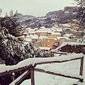 Winter Panorama
.JPG) manufacturing area
manufacturing area.JPG) Campomela railway station
Campomela railway station
References
| Wikimedia Commons has media related to Cargeghe. |
This article is issued from Wikipedia - version of the 8/19/2016. The text is available under the Creative Commons Attribution/Share Alike but additional terms may apply for the media files.