Cairnorrie
| Cairnorrie | |
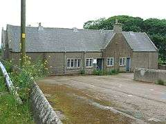 Cairnorrie Primary School (now closed) |
|
 Cairnorrie |
|
| OS grid reference | NJ862409 |
|---|---|
| Council area | Aberdeenshire |
| Lieutenancy area | Aberdeenshire |
| Country | Scotland |
| Sovereign state | United Kingdom |
| Post town | ELLON |
| Postcode district | AB41 |
| Dialling code | 01651 |
| Police | Scottish |
| Fire | Scottish |
| Ambulance | Scottish |
| EU Parliament | Scotland |
| UK Parliament | Banff and Buchan |
| Scottish Parliament | Aberdeenshire East |
Coordinates: 57°27′32″N 2°13′52″W / 57.459°N 2.231°W
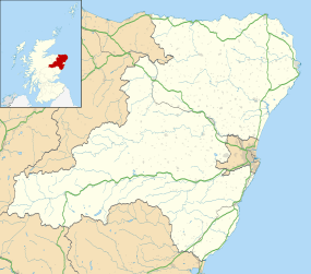
Cairnorrie is a rural settlement in the Formartine area of Aberdeenshire, Scotland, situated on the B9170 road between Methlick and New Deer. The primary school at Cairnorrie was closed in 2005.[1]
References
| Wikimedia Commons has media related to Cairnorrie. |
Settlements and places of interest in Formartine, Aberdeenshire | ||
|---|---|---|
| Primary settlements | 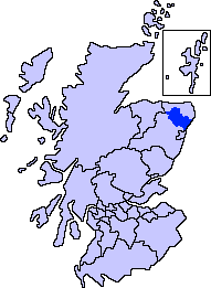 | |
| Other settlements | ||
| Places of interest | ||
Areas and primary settlements in Aberdeenshire (see also: Aberdeen City) | ||
|---|---|---|
| in Banff and Buchan |  | |
| in Buchan | ||
| in Formartine | ||
| in Garioch | ||
| in Kincardine and Mearns | ||
| in Marr | ||
This article is issued from Wikipedia - version of the 2/14/2016. The text is available under the Creative Commons Attribution/Share Alike but additional terms may apply for the media files.