Cabharstadh
| Cabharstadh | |
| Scottish Gaelic: Cabharstaigh | |
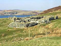 A ruined blackhouse and enclosures at the end of the Caversta Road |
|
 Cabharstadh |
|
| Language | Scottish Gaelic |
|---|---|
| English | |
| OS grid reference | NB364200 |
| Civil parish | Lochs |
| Council area | Na h-Eileanan Siar |
| Lieutenancy area | Western Isles |
| Country | Scotland |
| Sovereign state | United Kingdom |
| Post town | ISLE OF LEWIS |
| Postcode district | HS2 |
| Dialling code | 01851 |
| Police | Scottish |
| Fire | Scottish |
| Ambulance | Scottish |
| EU Parliament | Scotland |
| UK Parliament | Na h-Eileanan an Iar |
| Scottish Parliament | Na h-Eileanan an Iar |
Coordinates: 58°05′28″N 6°28′19″W / 58.091°N 6.472°W
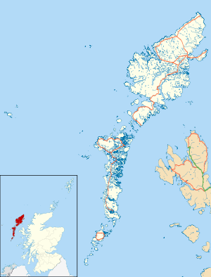
Cabharstadh or Caversta (Scottish Gaelic: Cabharstaigh) is a village on Lewis in the Outer Hebrides, Scotland. Caversta is situated in the district of Pairc,[1] and is within the parish of Lochs.[2]
References
- ↑ "Pairc". Hebridean Connections. Retrieved 24 December 2014.
- ↑ "Details of Parish of Lochs". Scottish Places. Retrieved 24 December 2014.
External links
| Wikimedia Commons has media related to Cabharstadh. |
| Inhabited islands | ||
|---|---|---|
| Other islands | ||
| Settlements |
| |
| Districts | ||
| Geographical features | ||
| Historical sites | ||
This article is issued from Wikipedia - version of the 6/9/2016. The text is available under the Creative Commons Attribution/Share Alike but additional terms may apply for the media files.