Bridgeport State Park
| Bridgeport State Park | |
| Washington State Park | |
 | |
| Country | United States |
|---|---|
| State | Washington |
| County | Okanogan |
| Elevation | 994 ft (303 m) [1] |
| Coordinates | 48°00′51″N 119°36′34″W / 48.01417°N 119.60944°WCoordinates: 48°00′51″N 119°36′34″W / 48.01417°N 119.60944°W [1] |
| Area | 748 acres (303 ha) |
| Established | Unspecified |
| Management | Washington State Parks and Recreation Commission |
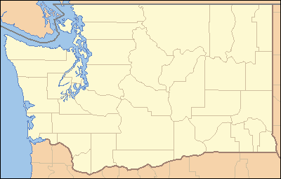 Location in the state of Washington
| |
| Website: Bridgeport State Park | |
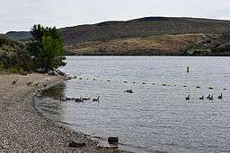
Bridgeport State Park is a 748-acre (303 ha) Washington state park in Okanogan County with 7,500 feet (2,300 m) of shoreline on Rufus Woods Lake, the reservoir behind Chief Joseph Dam.[2] The park offers camping, 4 miles (6.4 km) of hiking trails, boating, fishing, swimming, waterskiing, sailboarding, and golf.[3]
References
- 1 2 "Bridgeport State Park". Geographic Names Information System. United States Geological Survey.
- ↑ "Bridgeport State Park". U.S. Army Corps of Engineers. Retrieved February 17, 2016.
- ↑ "Bridgeport State Park". Washington State Parks and Recreation Commission. Retrieved February 17, 2016.
External links
- Bridgeport State Park Washington State Parks and Recreation Commission
- Bridgeport State Park Map Washington State Parks and Recreation Commission
This article is issued from Wikipedia - version of the 2/17/2016. The text is available under the Creative Commons Attribution/Share Alike but additional terms may apply for the media files.