Box Springs Mountains
| Box Springs Mountains | |
|---|---|
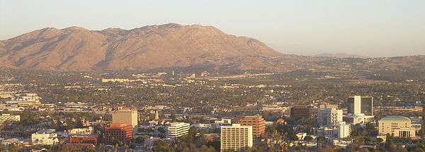 Box Springs Mountains with Riverside in foreground. | |
| Highest point | |
| Peak | Box Springs Mountain |
| Elevation | 939 m (3,081 ft) |
| Geography | |
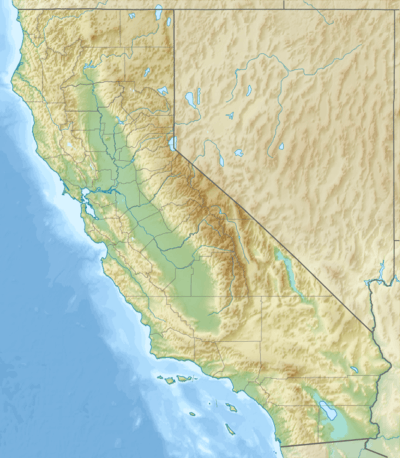 Location of the Box Springs Mountains in California [1] | |
| Country | United States |
| State | California |
| Region | Inland Empire |
| District | Riverside County |
| Range coordinates | 33°57′42″N 117°16′50″W / 33.9617°N 117.2806°W |
| Topo map | USGS Riverside East |
The Box Springs Mountains are a mountain range in northwest Riverside County, California, United States.[1] The highest peak in the range is Box Springs Mountain which is just over 3,080 feet (940 m).
Named Peaks
| Peak | Elevation | Coordinates |
|---|---|---|
| Box Springs Mountain | 3,080 feet (940 m) | 33°57′42″N 117°16′50″W / 33.96167°N 117.28056°W |
| Table Mountain | 2,359 feet (719 m) | 33°59′26″N 117°17′33″W / 33.99056°N 117.29249°W |
| Sugarloaf Mountain | 1,944 feet (593 m) | 33°59′37″N 117°19′21″W / 33.99371°N 117.32240°W |
| Jessie | 1,781 feet (543 m) | 33°56′56″N 117°17′00″W / 33.94876°N 117.28339°W |
| Pigeon | 1,423 feet (434 m) | 33°59′35″N 117°19′46″W / 33.99295°N 117.32944°W |
| Versity | 1,386 feet (422 m) | 33°58′04″N 117°19′27″W / 33.96773°N 117.32430°W |
References
| Wikimedia Commons has media related to Box Springs Mountains. |
- 1 2 "Box Springs Mountains". Geographic Names Information System. United States Geological Survey. Retrieved 2009-05-04.
 |
Colton & Grand Terrace | Loma Linda & San Bernardino | Redlands | |
| Riverside | |
Yucaipa & Beaumont | ||
| ||||
| | ||||
| Riverside | Moreno Valley & Lake Perris | Hemet & San Jacinto |
This article is issued from Wikipedia - version of the 9/19/2016. The text is available under the Creative Commons Attribution/Share Alike but additional terms may apply for the media files.