Beelbangera
| Beelbangera New South Wales | |
|---|---|
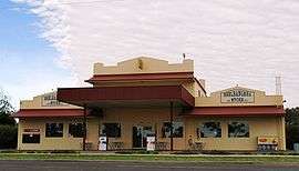 General store at Beelbangera | |
|
Beelbangera | |
| Coordinates | 34°16′0″S 146°6′0″E / 34.26667°S 146.10000°ECoordinates: 34°16′0″S 146°6′0″E / 34.26667°S 146.10000°E |
| Population | 311 (2011 census)[1] |
| Postcode(s) | 2680 |
| Location |
|
| LGA(s) | City of Griffith |
| County | Cooper |
| State electorate(s) | Murray |
| Federal Division(s) | Riverina |
Beelbangera is a town in the north west of the Riverina and situated about 2 kilometres north-east from Griffith and about 7 kilometres south-west of Yenda. At the 2011 census Beelbangera had a population of 311.[1]
The place name Beelbangera is derived from the local Aboriginal word meaning "native companion".[3]
Beelbangera Post Office opened on 1 September 1919.[4]
Notes and references
- 1 2 Australian Bureau of Statistics (31 October 2012). "Beelbangera (State Suburbs)". 2011 Census QuickStats. Retrieved 30 March 2015.
- ↑ Travelmate Archived 25 March 2007 at the Wayback Machine.
- ↑ "Beelbangera". Geographical Names Register (GNR) of NSW. Geographical Names Board of New South Wales. Retrieved 13 June 2009.
- ↑ Premier Postal History. "Post Office List". Retrieved 2009-06-11.
External links
![]() Media related to Beelbangera, New South Wales at Wikimedia Commons
Media related to Beelbangera, New South Wales at Wikimedia Commons
| Preceding station | NSW Branch lines | Following station | ||
|---|---|---|---|---|
towards Roto | Temora- Roto Line | towards Temora |
This article is issued from Wikipedia - version of the 11/14/2016. The text is available under the Creative Commons Attribution/Share Alike but additional terms may apply for the media files.