Arrats
| Arrats | |
|---|---|
_moulin_sur_un_bras_de_l'Arrats.JPG) The river in L'Isle-Arné | |
| Country | France |
| Basin | |
| Main source | Plateau de Lannemezan |
| River mouth |
Garonne 44°5′42″N 0°50′48″E / 44.09500°N 0.84667°ECoordinates: 44°5′42″N 0°50′48″E / 44.09500°N 0.84667°E |
| Progression | Garonne→ Atlantic Ocean |
| Physical characteristics | |
| Length | 162 km (101 mi) |
The Arrats is a 162 km long river in southern France, left tributary of the Garonne. Its source is in the northern foothills of the Pyrenees, near Sariac-Magnoac. It flows north through the following départements and towns:
It flows into the Garonne near Valence, between Castelsarrasin and Agen.
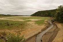
The Arrats flowing into the Réservoir de l'Astarac
References
This article is issued from Wikipedia - version of the 4/12/2016. The text is available under the Creative Commons Attribution/Share Alike but additional terms may apply for the media files.