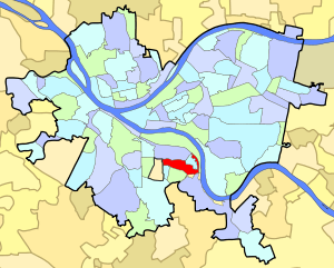
Arlington (Pittsburgh)
| Arlington | |
|---|---|
| Neighborhood of Pittsburgh | |
|
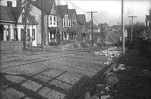
Arlington Avenue, Arlington, Pittsburgh, 1907 | |
 | |
| Coordinates: 40°24′54″N 79°58′12″W / 40.415°N 79.970°W | |
| Country | United States |
| State | Pennsylvania |
| County | Allegheny County |
| City | Pittsburgh |
| Area[1] | |
| • Total | 0.47 sq mi (1.2 km2) |
| Population (2010)[2] | |
| • Total | 1,869 |
| • Density | 4,000/sq mi (1,500/km2) |
| ZIP Code | 15210 |
Arlington is a neighborhood in southern Pittsburgh, Pennsylvania. The zip code used by residents is 15210, and the neighborhood has representation on Pittsburgh City Council by the council member for District 3 (Central South Neighborhoods). The Pittsburgh Bureau of Fire houses 22 engine in Arlington. The city has discussed the possibility of closing 22 engine completely. 22 engine is a vital key to second and third alarm firefighting in the city.
Surrounding Pittsburgh neighborhoods
Arlington Heights, Hays, Mount Oliver, St. Clair, South Side Flats, South Side Slopes.
| Historical population | |||
|---|---|---|---|
| Census | Pop. | %± | |
| 1940 | 2,702 | — | |
| 1950 | 3,203 | 18.5% | |
| 1960 | 4,430 | 38.3% | |
| 1970 | 3,949 | −10.9% | |
| 1980 | 2,294 | −41.9% | |
| 1990 | 2,210 | −3.7% | |
| 2000 | 1,999 | −9.5% | |
| 2010 | 1,869 | −6.5% | |
References
- ↑ "Census: Pittsburgh". Pittsburgh Department of City Planning. April 2013. Retrieved 2013-04-26.
- ↑ "Census: Pittsburgh" (PDF). Pittsburgh Department of City Planning. January 2006. Archived from the original (PDF) on 2007-08-10. Retrieved 2007-07-19.
Further reading
- Toker, Franklin (1994) [1986]. Pittsburgh: An Urban Portrait. Pittsburgh: University of Pittsburgh Press. ISBN 0-8229-5434-6.
See also
External links
This article is issued from Wikipedia - version of the 10/18/2016. The text is available under the Creative Commons Attribution/Share Alike but additional terms may apply for the media files.