Analanjirofo
| Analanjirofo Region | |
|---|---|
| Region | |
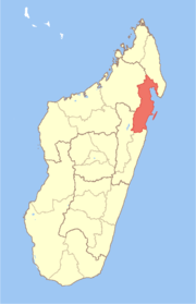 Location in Madagascar | |
| Country |
|
| Area | |
| • Total | 21,930 km2 (8,470 sq mi) |
| Population (2013) | |
| • Total | 1,035,132 |
| • Density | 47/km2 (120/sq mi) |
| Time zone | EAT (UTC3) |
Analanjirofo is a region in northeastern Madagascar. Until 2009 it was a part of Toamasina Province. It borders Sava Region to the north, Sofia Region to the west, Alaotra-Mangoro Region to the southwest and Atsinanana Region to the south.
The capital of the region is Fenoarivo Atsinanana (French: Fénérive Est), and the population was estimated to be 1,035,132 in 2013.[1] The area of Analanjirofo Region is 21,930 km2 (8,467 sq mi).[2]
Administrative divisions
Analanjirofo region is divided into six districts, which are sub-divided into 63 communes.
- Fenerive Est District (Fenerive Est, Fenoarivo Atsinanana)
- Mananara Nord District (Mananara Nord, Mananara Avaratra)
- Maroantsetra District (Maroantsetra)
- Nosy-Boraha District (Nosy-Boraha, Île Sainte-Marie)
- Soanierana Ivongo District (Soanierana Ivongo)
- Vavatenina District (Vavatenina)
Protected areas
- Part of Zahamena Reserve and Zahamena National Park
- Mananara Nord National Park
- Part of Masoala National Park
- Nosy Mangabe Reserve
- Ambatovaky Reserve
References
- ↑ Institut National de la Statistique, Antananarivo.
- ↑ "Madagascar: Profil des marchés pour les évaluations d'urgence de la sécurité alimentaire" (PDF) (in French). Retrieved 2008-02-24.
| Fenerive Est | | |
|---|---|---|
| Mananara Nord | ||
| Maroantsetra | ||
| Sainte Marie | ||
| Soanierana Ivongo | ||
| Vavatenina | ||
Coordinates: 16°35′39″S 49°26′19″E / 16.59417°S 49.43861°E
This article is issued from Wikipedia - version of the 4/6/2016. The text is available under the Creative Commons Attribution/Share Alike but additional terms may apply for the media files.