Alamnagar
For the assembly constituency, see Alamnagar (Vidhan Sabha constituency).
| Alamnagar आलमनगर सामुदायिक विकास खंड | |
|---|---|
| Community development block | |
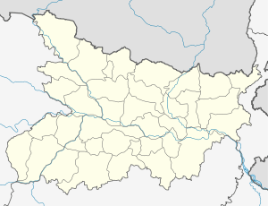 Alamnagar  Alamnagar Location in Bihar, India | |
| Coordinates: 25°32′56″N 86°54′40″E / 25.54889°N 86.91111°ECoordinates: 25°32′56″N 86°54′40″E / 25.54889°N 86.91111°E | |
| Country |
|
| State | Bihar |
| District | Madhepura |
| Population (2001) | |
| • Total | 129,226 |
| Languages | |
| • Official | Maithili, Hindi |
| Time zone | IST (UTC+5:30) |
| Lok Sabha constituency | Madhepura |
| Vidhan Sabha constituency | Alamnagar |
| Website |
madhepura |
Alamnagar (community development block) is one of the administrative divisions of Madhepura district in the Indian state of Bihar. The block headquarters are located at a distance of 58 km from the district headquarters, namely, Madhepura.
Geography
Alamnagar is located at 25°32′56″N 86°54′40″E / 25.54889°N 86.91111°E
Panchayats
Panchayats in Alamnagar community development block are: Bispatti, Basanbara, Khuran, Bargaon, Singhar, Itahari, Alamnagar North, Alamnagar South, Alamnagar East, Northua Bhagipur, Kujauri, Gangapur, Kishanpur Ratwara and Khapur.[1]
Demographics
In the 2001 census Alamnagar Block had a population of 129,226.[2]
References
- ↑ "Alamnagar Block". Blocks of Madhepura. brandbihar.com. Retrieved 2011-02-07.
- ↑ "Republic of India, Bihar". Geo Hive. Retrieved 2011-02-07.
This article is issued from Wikipedia - version of the 9/20/2016. The text is available under the Creative Commons Attribution/Share Alike but additional terms may apply for the media files.