Ada Township, Perkins County, South Dakota
| Ada Township, South Dakota | |
|---|---|
| Township | |
| Coordinates: 45°20′38″N 102°24′39″W / 45.34389°N 102.41083°WCoordinates: 45°20′38″N 102°24′39″W / 45.34389°N 102.41083°W | |
| Country | United States |
| State | South Dakota |
| County | Perkins |
| Area | |
| • Total | 35.6 sq mi (92.3 km2) |
| • Land | 35.4 sq mi (91.8 km2) |
| • Water | 0.2 sq mi (0.5 km2) |
| Elevation | 2,484 ft (757 m) |
| Population (2000) | |
| • Total | 23 |
| • Density | 0.6/sq mi (0.3/km2) |
| Time zone | Mountain (MST) (UTC-7) |
| • Summer (DST) | MDT (UTC-6) |
| ZIP code | 57620 |
| Area code(s) | 605 |
| FIPS code | 46-00220[1] |
| GNIS feature ID | 1269024[2] |
Ada (ZIP code 57644) is a rural township in Perkins County, South Dakota, with a population of 557.
References
- ↑ "American FactFinder". United States Census Bureau. Archived from the original on 2013-09-11. Retrieved 2008-01-31.
- ↑ "US Board on Geographic Names". United States Geological Survey. 2007-10-25. Retrieved 2008-01-31.
Municipalities and communities of Perkins County, South Dakota, United States | ||
|---|---|---|
| City | 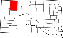 | |
| Town | ||
| Townships |
| |
| CDP | ||
| Other unincorporated communities | ||
| Ghost towns | ||
This article is issued from Wikipedia - version of the 10/3/2016. The text is available under the Creative Commons Attribution/Share Alike but additional terms may apply for the media files.